Note: El Niño and La Niña are the extreme phases of the ENSO cycle; between these two phases is a third phase called ENSO-neutral.
|
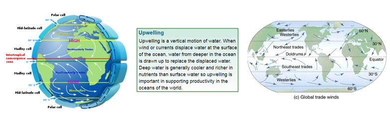
Concepts we need to know before we delve deeper into the ENSO mechanism A thermocline is the transition layer between the warmer water at the surface and the cooler deep water below. The trade winds or easterlies are the permanent east-to-west prevailing winds that flow in the Earth's equatorial region (between 30°N and 30°S latitudes). Convection is the process generally associated with warm rising air and the formation of cloud.
|

.png)
.png)
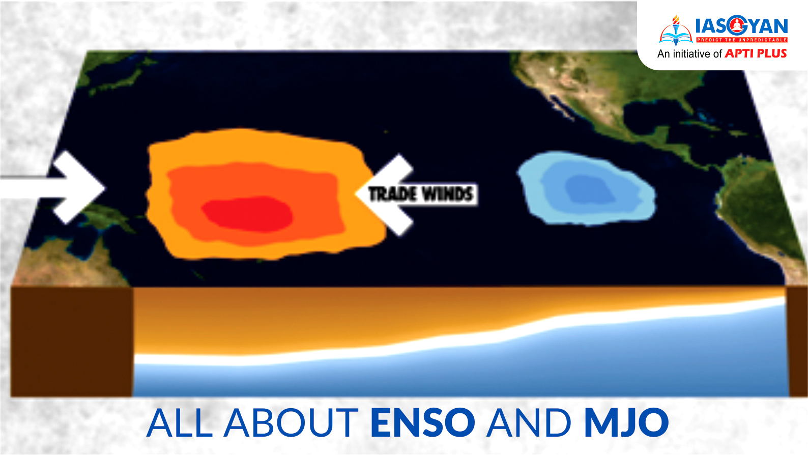
The 'Neutral phase'
Note: The pattern of air rising in the west and falling in the east with westward moving air at the surface is referred to as the Walker Circulation.
.png)
.png)

.png)
.png)
.png)

La Niña Phase
|
ENSO and India El Nino and La Nina impact India greatly. |
.png)

Disclaimer: No copyright infringement intended.
© 2025 iasgyan. All right reserved