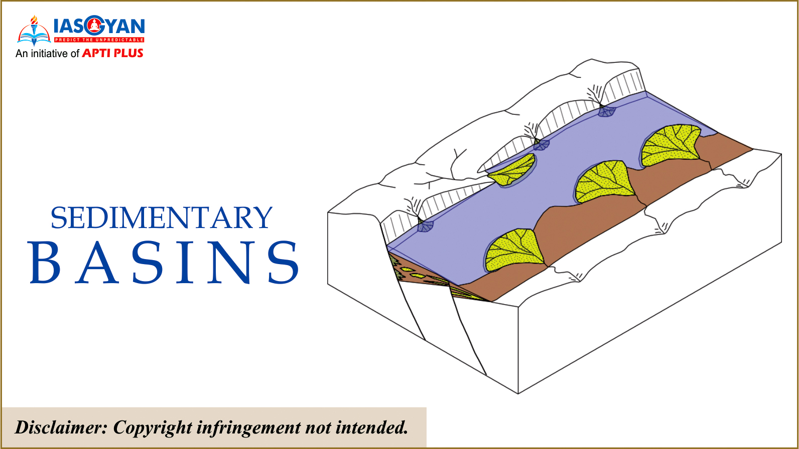
Sedimentary basins are places where subsidence of Earth's crust has allowed sediment to accumulate on top of a basement of igneous and metamorphic rocks.
Over geologic time these sediments and associated fluids are chemically and mechanically transformed through the compaction and heating associated with basin subsidence.
These transformations yield the energy resources of petroleum, natural gas, coal, geothermal energy, and uranium.
They also lead to the precipitation of a wide range of ores for important metals such as copper, lead, zinc, iron, and mercury.
Types of Basins
The style of evolution of a basin depends on the tectonic realm where it is located
The mechanism of the basin formation and its development therefore vary according to the tectonic processes of the setup.
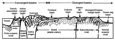
Thus basins are classified and grouped under three plate tectonic processes:
Divergent
convergent
Transform setting
Geologists distinguish among different kinds of sedimentary basins in the context of plate tectonics theory. Let’s consider a few examples.
Rift basins: These form in continental rifts, regions where the lithosphere is stretching horizontally, and therefore thins vertically. As the rift grows, slip on faults drops blocks of crust down, producing low areas bordered by narrow mountain ridges. These troughs fill with sediment.
Passive-margin basins:These form along the edges of continents that are not plate boundaries. They are underlain by stretched lithosphere, the remnants of a rift whose evolution successfully led to the formation of a mid-ocean ridge and subsequent growth of a new ocean basin. Passive-margin basins form because subsidence of stretched lithosphere continues long after rifting ceases. They fill with sediment carried to the sea by rivers and with carbonate rocks formed in coastal reefs.
Intra-continental basins:These develop in the interiors of continents, initially because of subsidence over a rift. They may continue to subside in pulses even hundreds of millions of years after they formed, for reasons that are not well understood.
Foreland basins: These form on the continent side of a mountain belt because the forces produced during convergence or collision push large slices of rock up faults and onto the surface of the continent. The weight of these slices pushes down on the surface of the lithosphere, producing a wedge-shaped depression adjacent to the mountain range that fills with sediment eroded from the range. Fluvial and deltaic strata accumulate in foreland basins.
The recent discovery
Discovery of the Ashoknagar Well made the Bengal basin India’s eighth producing sedimentary basin.
The other basins are --- Krishna-Godavari (KG), Mumbai Offshore, Assam Shelf, Rajasthan, Cauvery, Assam-Arakan Fold Belt and Cambay.
The above seven basins of India produce 83 percent of established oil and gas reserves.
Sedimentary Basins of India
According to the Directorate General of Hydrocarbons, there are 26 sedimentary basins in India.
They cover a total area of 3.4 million square kilometer.
Of these, 16 are on land basins, 7 located both on land and offshore and 3 completely offshore.
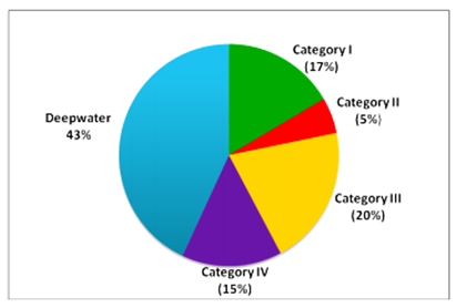
Broadly Indian sedimentary basins have been divided into four categories based on maturity of hydrocarbon resources as under:
Category-I: Basins, which have reserves and already producing.
Category-II: Basins, which have contingent resources pending commercial production
Category-III Basins, which have prospective resources awaiting discovery
The categorization based on the prospectivity of the basin as presently known is as under:
Crude oil & natural gas production in the country is from 7 basins under category-I and deepwater areas.
In category-II basins, hydrocarbon discoveries have been made but commercial production is yet to commence.
The distribution of total Indian sedimentary area of 3.14 million square kilometre under different categories and deepwater is here:
3.png)

3.png)
.png)
1.png)

1.png)