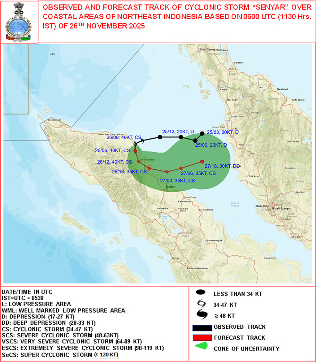
Description

Disclaimer: Copyright infringement not intended.
Context: Beki River changing course, displacing state highway a study by Down to Earth.
Details
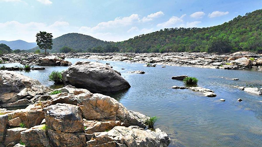
About the River
- Beki River is one of the right bank tributaries of the Brahmaputra River, originates from the Mountain Reserve Forest at Mathanguri.
- Flows from North to South direction from the Bhutan region but a large portion flows in Indian state Assam.
- This river is also known as the Kurisu river in Bhutan.
- It flows through the Manas National Park.
- The climate is extremely varied, ranging from hot and humid subtropical conditions in the south to cold and dry alpine conditions in the north.
|
Major Tributaries of Brahmaputra River
|
|
Right Bank
|
Left Bank
|
|
Subansiri, Ronganadi, Dikrong, Buroi, Borgong, Jiabharali, Dhansiri (North) Puthimari, Manas, Beki, Aie, Sonkosh
|
Noadehing, Buridehing, Desang, Dikhow, Bhogdoi, Dhansiri, Kopilli, Kulsi, Krishnai, Dhdhnoi, Jinjiran
|
Morphological dynamics of Beki River.
- During the monsoon, the Beki swells up and is hard to predict. The soil is porous, with subterranean flows which further induces erosion like the Bhabar belt.
- The river channel changes its course due to changes in rainfall pattern, heavy landslide in catchment area causing sudden rise in the silt load,impact of seismic activity in bed slope.
- Manas-Beki river system dynamics is in terms of bank line, alteration of direction of flow due to neck cut off, widening of channel and progressive shifting of meander bends.
- The river’s bank is being eroded during its meandering course through Barpeta and Baksa districts.
Meandering
Rivers flowing over gently sloping ground begin to curve back and forth across the landscape. These are called meandering rivers.
Meandering rivers erode sediment from the outer curve of each meander bend and deposit it on an inner curve further down stream. This causes individual meanders to grow larger and larger over time.
- 2004 was the year when the Beki started to carry 80 per cent of the silt load of two rivers — itself and the Manas, which flows into the Brahmaputra.
- Another reason is sudden flooding due to water release from Kurichu dam in Bhutan during this period.
- Beki river which was flowing westward in its upstream course and eastward downstream, changed its path. This caused severe erosion in the Manas National Park upstream.
Consequence
- Several houses and trees near the river and National Highways and roads were swallowed by floodwaters due to erosion.
Initiatives taken to control erosion.
- In an effort to control the erosion of the Beki River in the area, the government’s water resources department constructed a geo-bag dam.
More: https://www.iasgyan.in/daily-current-affairs/beki-river
Sources:
Downtoearth.
|
PRACTICE QUESTION
Q.consider the following following rivers?
1. Manas
2. Beki
3. Aie
4. Sonkosh
How many of the above is/are right bank tributaries of Brahmaputra?
A. Only one
B. Only two
C. Only three
D. All four
Answer D
|