


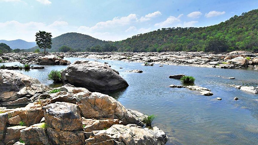
Bharathapuzha, originating from small streams in the Western Ghats, flows west through Kerala, serving as the lifeblood of the region. It supports irrigation through its 13 reservoirs and holds cultural significance, especially near Cheruthuruthy. The river faces challenges like lower water flow due to dry catchments and pollution, impacting its ecosystems.


Disclaimer: Copyright infringement not intended.
Recently, A family of four drowned in the Bharathapuzha at Painkulam, near Cheruthuruthy.
|
Aspect |
Details |
|
Origin |
Small streams in various parts of the Western Ghats near the Anamalai range in Tamil Nadu. |
|
Flow Path |
Flows west through the Palakkad Gap (Palghat Gap), through the Palakkad and Malappuram districts of Kerala, with many tributaries joining it. |
|
Tributaries |
Tirur River (major), Gayathripuzha, Kalpathipuzha, and Pulanthode. |
|
Catchment Area |
Kerala: 4,400 km², Tamil Nadu: 1,786 km². |
|
Water Flow |
Lower compared to other long rivers in Kerala due to a significant portion of the catchment being in dry areas (Tamil Nadu and Palakkad Gap). |
|
Rainfall |
2,000 to 2,800 mm in steep areas, 3,000 mm along the coast, during the southwest monsoon. |
|
Temperature |
Varies by season as the basin lies in the tropical zone. |
|
Reservoirs/Dams |
13 structures, including Aliyar Dam, Thirumurthi Reservoir, Malampuzha Reservoir (largest), Walayar Dam, Mangalam Dam, Pothundi Dam, and others. |
|
Usage of Reservoirs |
Primarily used for irrigation. |
|
Cultural Significance |
Known as the "cultural lifeblood of Kerala." Kerala Kalamandalam, a prominent performing arts center, is located at Cheruthuruthy on its banks. |
|
Historical Name |
Referred to as "Peraar" in ancient inscriptions and records. |
|
River |
Origin |
Course |
Tributaries |
Significance |
Challenges |
|
Periyar River |
Sivagiri peaks, Peerumedu, Idukki district, Kerala |
Flows southwest through Idukki, Ernakulam, and Thrissur districts, covering ~244 km. |
Mullayar, Cheruthoni, Perinjankutti |
Water supply for irrigation and domestic use, Idukki Dam for hydroelectric power, Periyar Wildlife Sanctuary (biodiversity, elephants, tigers, birds). |
Pollution, deforestation, and encroachments threaten the ecosystem and water quality. |
|
Pamba River |
Pulachimalai Hills, Peerumedu taluk, Idukki district, Kerala |
Flows south through Pathanamthitta and Alappuzha districts, covering ~176 km before draining into the Vembanad Lake. |
Kakki, Achankovil, Manimala |
Religious significance (Sabarimala pilgrimage), supports wetlands, marshes, forests, agriculture, hydroelectric projects (e.g., Sabarigiri Hydroelectric Project). |
Pollution (agriculture, industries, waste), deforestation, and ecological degradation. |
|
Chaliyar River |
Elambalari Hills, Nilambur, Kerala |
Flows through Malappuram and Kozhikode districts. |
Not specified |
Important for agriculture and industrial purposes. |
Industrial pollution (e.g., effluents) and sand mining. |
|
Meenachil River |
Palai, Kottayam district, Kerala |
Flows through Kottayam district and drains into the Vembanad Lake. |
Not specified |
Provides water for irrigation, supports agriculture. |
Pollution and water management issues. |
Source:
|
PRACTICE QUESTION
Which of the above statements is/are correct?
Answer: a Explanation: Statement 1 is correct: The Bharathapuzha River originates from small streams in various parts of the Western Ghats near the Anamalai range in Tamil Nadu. Statement 2 is incorrect: While the Bharathapuzha River flows primarily through Kerala, its catchment area is shared between Kerala (4,400 km²) and Tamil Nadu (1,786 km²). The three main tributaries of the Bharathapuzha River are Gayathripuzha, Kalpathipuzha, and Pulanthode. |

© 2025 iasgyan. All right reserved