Description
Context: Rainfall over the Southern peninsular region has been deficient so far.
- The reason is a prevalent La Niña condition, along with a low pressure belt that is currently lying to the north of its normal position.
What is the Northeast monsoon, and why is it important?
- India receives rainfall during two seasons. About 75 per cent of the country’s annual rainfall is received from the Southwest monsoon between June and September.
- The Northeast monsoon, on the other hand, occurs during October to December, and is a comparatively small-scale monsoon, which is confined to the Southern peninsula.
- Also called the winter monsoon, the rainfall associated with the Northeast monsoon is important for Tamil Nadu, Puducherry, Karaikal, Yanam, coastal Andhra Pradesh, Kerala, north interior Karnataka, Mahe and Lakshadweep.
- Some South Asian countries such as Maldives, Sri Lanka and Myanmar, too, record rainfall during October to December.
- Tamil Nadu records about 48 per cent (447.4 mm) of its annual rainfall (943.7 mm) during these months, making it the key factor for undertaking agricultural activities and reservoir management in the state.
- After the complete withdrawal of the Southwest monsoon from the country takes place by mid-October, the wind pattern rapidly changes from the south-westerly to the north-easterly direction.
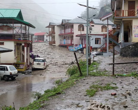
- The period after the Southwest monsoon season, from October to December, is the peak time for cyclonic activity in the North Indian Ocean region — covering the Arabian Sea and the Bay of Bengal.
- The winds associated with the formation of low pressure systems, depressions, or cyclones influence this monsoon, and therefore, the rainfall.
- Timely information on cyclones thus become vital for governments and disaster management teams to plan contingency.
What is the reason for the deficiency of rainfall this season?
- Officials at IMD have linked it to the prevailing La Niña conditions in the Pacific Ocean.
- While El Niño (Spanish for ‘little boy’), the expression heard more commonly in India, is the abnormal surface warming observed along the eastern and central regions of the Pacific Ocean (region between Peru and Papua New Guinea), La Niña (Spanish for ‘little girl’) is an abnormal cooling of these surface waters.
- Together, the El Niño and La Niña phenomena are termed as El Niño Southern Oscillation (ENSO).
- These are large-scale ocean phenomena which inflence the global weather — winds, temperature and rainfall.
- They have the ability to trigger extreme weather events like droughts, floods, hot and cold conditions, globally.
- Each cycle can last anywhere between 9 to 12 months, at times extendable to 18 months — and re-occur after every three to five years.
- Meteorologists record the sea surface temperatures for four different regions, known as Niño regions, along this equatorial belt.
- Depending on the temperatures, they forecast either as an El Niño, an ENSO neutral phase, or a La Niña.
But how is La Niña linked with the Northeast monsoon?
- While La Niña conditions enhance the rainfall associated with the Southwest monsoon, it has a negative impact on rainfall associated with the Northeast monsoon.
- La Niña years, the synoptic systems — low pressure or cyclones — formed in the Bay of Bengal remain significantly to the north of their normal position.
- The current position of the Inter Tropical Convective Zone (ITCZ) has also contributed to the poor rainfall during the ongoing monsoon season.
- The ITCZ is a low-pressure belt, whose northward and southward movements along the equator determine the precipitation in the tropics.
https://indianexpress.com/article/explained/india-northeast-monsoon-rainfall-deficiency-explained-7063467/
Array
(
[0] => daily-current-affairs/explained-why-has-the-northeast-monsoon-remained-subdued-this-year
[1] => daily-current-affairs
[2] => explained-why-has-the-northeast-monsoon-remained-subdued-this-year
)