Description
Copyright infringement is not intended
Context: The ‘India State of Forest Report (ISFR) 2021’ released.
What is the India State of Forest Report?
- It is an assessment of India’s forest and tree cover.
- It is published every two years.
- Published by: the Forest Survey of India under the Ministry of Environment, Forests and Climate Change.
- First survey was published in
- ISFR 2021 is the 17th.
- Data collection method: Data computed through wall-to-wall mapping of India’s forest cover through remote sensing techniques.
- Significance of the ISFR:
- Provide information provides inputs for various global level inventories, reports such as GHG Inventory, Growing Stock, Carbon Stock, Forest Reference Level (FRL) and international reporting to UNFCCC targets under CBD Global Forest Resource Assessment (GFRA) for planning and scientific management of forests.
- Information given in the report would provide valuable information for policy, planning and sustainable management of forest and tree resources in the country.
What are the key findings of ISFR 2021?
- ISFR-2021 provides information on
- forest cover and tree cover
- mangrove cover
- growing stock and carbon stock in India’s forests
- forest fire monitoring
- forest cover in tiger reserve areas:
- above ground estimates of biomass using SAR data & climate change hotspots in Indian forests.
MAJOR FINDINGS
1) Total forest and tree cover
- Existing situation: The total forest and tree cover of the country is 80.9 million hectare which is 24.62 percent of the geographical area of the country.
- Bamboo forests have grown from 13,882 million culms (stems) in 2019 to 53,336 million culms in 2021.
- In comparison to 2019 report:
- As compared to the assessment of 2019, there is an increase of 2,261 sq km in the total forest and tree cover of the country.
- Out of this, the increase in the forest cover has been observed as 1,540 sq km and that in tree cover is 721 sq km.
- Increase in forest cover has been observed in open forest followed by very dense forest.
- Five states in the Northeast – Arunachal Pradesh, Manipur, Meghalaya, Mizoram and Nagaland have all shown loss in forest cover.
- Top three states: showing increase in forest cover are
- Andhra Pradesh (647 sq km) followed by
- Telangana (632 sq km) and
- Odisha (537 sq km).
- Top states in terms of Area-wise forest cover are
- Madhya Pradesh has the largest forest cover in the country followed by
- Arunachal Pradesh,
- Chhattisgarh,
- Odisha and
- Maharashtra
- Top states in terms of Forest cover as percentage of total geographical area are
- Mizoram (84.53%)
- Arunachal Pradesh (79.33%)
- Meghalaya (76.00%)
- Manipur (74.34%) and
- Nagaland (73.90%)
- States and UT’s that have more than 75 percent forest cover are
- Lakshadweep
- Mizoram
- Andaman & Nicobar Islands
- Arunachal Pradesh and
- Meghalaya
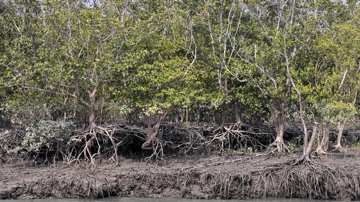
2) Mangrove cover:
- Total mangrove cover in the country is 4,992 sq km.
- In comparison to 2019 report: An increase of 17 sq Km in mangrove cover has been observed as compared to the previous assessment of 2019.
- Top three states showing mangrove cover increase are
- Odisha (8 sq km) followed by
- Maharashtra (4 sq km) and
- Karnataka (3 sq km).
3) Total carbon stock:
- Total carbon stock in country’s forest is estimated to be 7,204 million tones.
- In comparison to 2019 report: There an increase of 79.4 million tonnes in the carbon stock of country as compared to the last assessment of 2019.
4) Forest fire:
- 46 % of the forest cover is prone to forest fires.
- Out of this, 2.81 % is extremely prone, 7.85% is very highly prone and 11.51 % is highly prone.
- The highest numbers of fires were detected in Odisha, Madhya Pradesh and Chhattisgarh.
5) Forest cover in the Tiger Reserve:
- FSI has included a new chapter related to the assessment of forest cover in the Tiger Reserves, Corridors and Lion conservation area of India.
- Change in forest cover, during the period between ISFR 2011 (data period 2008 to 2009) and the current cycle (ISFR 2021, data period 2019-2020) within each Tiger Reserves has been analysed.
- The forest cover in tiger corridors has increased by 37.15 sq km (0.32%) between 2011-2021, but decreased by 22.6 sq km (0.04%) in tiger reserves.
- Pakke Tiger Reserve in Arunachal Pradesh has the highest forest cover, at nearly 97%.
- Importance: Decadal assessment of change in forest cover within Tiger Reserves, Corridors and Lion conservation area helps in assessing the impact of conservation measures and management interventions that have been implemented over the years.
6) Above Ground Biomass
- FSI, in collaboration with Space Application Centre (SAC), ISRO, Ahmedabad, initiated a special study for estimation of Above Ground Biomass (AGB) at pan-India level, using L- band of Synthetic Aperture Radar (SAR) data.
- The results for the States of Assam and Odisha (as well as AGB maps), were presented earlier in ISFR 2019.
7) ‘Mapping of Climate Change Hotspots in Indian Forests’
- FSI in collaboration of with Birla Institute of Technology & Science (BITS) Pilani, Goa Campus has performed a study based on ‘Mapping of Climate Change Hotspots in Indian Forests’.
- Objective was to map the climatic hotspots over the forest cover in India, using computer model-based projection of temperature and rainfall data, for the three future time periods i.e. year 2030, 2050 and 2085.
What kind of forests are growing?
- ISFR 2021 has shown an increasing trend in forest cover overall, the trend is not uniform across all kinds of forests.
- Three categories of forests are surveyed
- very dense forests (canopy density over 70%)
- moderately dense forests (40-70%) and
- open forests (10-40%)
Scrubs (canopy density less than 10%) are also surveyed but not categorised as forests.
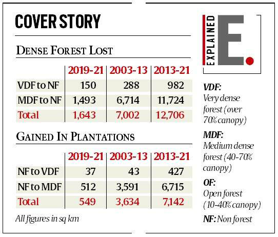
ISFR 2021 FINDINGS:
a)Very dense forests: increased by 501 sq km.
- b) Moderately dense forests, or “natural forests: there is a 1,582 sq km decline.
- c) Open forest areas: there is an increase of 2,621 sq km.
- d) Scrub area: It has increased by 5,320 sq km.
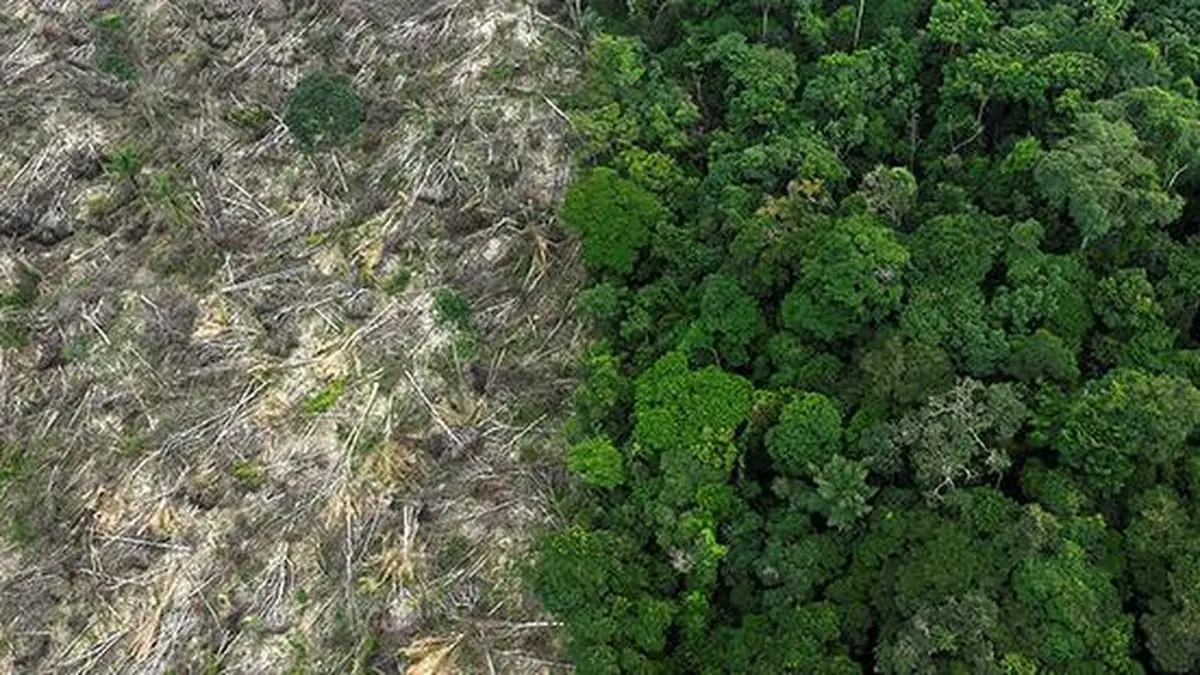
What explains the decline in the Northeastern states?
- Northeast states account for 7.98% of total geographical area but 23.75% of total forest cover.
- Forest cover in northeast states shown an overall decline of 1,020 sq km.
- Reason for decline in forested areas: are natural calamities, particularly landslides and heavy rains, in the region as well as to anthropogenic activities such as shifting agriculture, pressure of developmental activities and felling of trees.
- Challenge: Northeastern states follow a different ownership pattern — community ownership and protected tribal land – which makes conservation activities challenging.
What impact has climate change had?
- The report estimates that by 2030, 45-64% of forests in India will experience the effects of climate change.
- Ladakh (forest cover 0.1-0.2%) is likely to be the most affected.
How comprehensive a picture does the survey present?
- Survey results could be misleading as it includes plantations – such as coffee, coconuts or mango and other orchards – under forest cover.
- These plantations are distinctly different from natural forests where one hectare would be home to hundreds of species of trees, plants and fauna, whereas such plantations house only one species of tree.
Forest land in India:
- The word ‘forest’ is not defined in any Central Forest Act, namely the Indian Forest Act (1927), or the Forest Conservation Act (1980).
- The term ‘forest’ is yet to be defined by the Centreas the Central government has not laid down any criterion to define forest.
- Out of the recorded forest area in the country, 4,34,853 sq km fall under the Reserved Forests category, 2,18,924 sq km under the Protected Forests category, and 1,13,642 sq km are of unclassed forests.
Forest cover and tree cover
- The Ministry of Environment, Forest & Climate Change defines
- ‘Forest cover’ in India as “all lands, more than one hectare in area with a tree canopy density of more than 10%”, and
- ‘Tree cover’as “tree patches outside recorded forest areas exclusive of forest cover and less than the minimum mappable area of one hectare”.
- ‘Trees outside forest’, or TOF as “trees existing outside the recorded forest area in the form of block, linear & scattered size of patches”. Since tree cover measures only non-forest patches that are less than 1 hectare, it is only a part of TOF.
- Forest also has legal connotation. An area of land recorded as forest in revenue records or proclaimed to be forest under a forest law or Act is also described as forest.
- Thus, “forest area” is an area recorded as forest in the government records. Often this term is also written as “recorded forest area”.
- The recorded forest area is categorized into “Reserved Forest”, “Protected Forest” and “Unclassed Forest”.
- Reserved Forest: An area notified under the provisions of India Forest Act or the State Forest Acts having full degree of protection. In Reserved Forests all activities are prohibited unless permitted.
- Protected Forest: An area notified under the provisions of India Forest Act or the State Forest Acts having limited degree of protection. In Protected Forests all activities are permitted unless prohibited.
- Unclassed Forest: An area recorded as forest but not included in reserved or protected forest category. Ownership status of such forests varies from state to state.
Wasteland in India:
- As per the Wasteland Atlas, 2019, published by the Ministry of Rural Development, the total wasteland in the country is 5,57,665.51 sq km.
- Wasteland is defined not as desertified land, but land that not used for agriculture, commercial use or as forest land. For instance, it could use grasslands, that are used by communities for grazing.
State’s Power:
- State are responsible for categorising forest land, and resolving dispute between these two departments.
- The Indian Forest Act, 1927 gives statesthe rights to notify Reserved Forests in their areas.
https://indianexpress.com/article/explained/takeaways-from-india-state-of-forest-report-7722163/