Description
Disclaimer: Copyright infringement not intended.
Context
- How has the Indian monsoon been affected by global warming? What has a new study on large-scale extreme rainfall found and what is its significance? How will this study improve forecasts and reduce risks associated with large-scale rainfall events?
More About the News
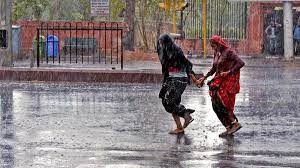
- The Indian monsoon has well-known features, such as the onset of the monsoon, the withdrawal, the active and break periods, and the low-pressure systems (or monsoon depressions).
- Every aspect of the monsoon has been affected by global warming.
- The total seasonal rainfall has also trended downwards for more than seven decades, due to the differential heating of the land versus the ocean due to global warming.
- However, this trend has been distributed unevenly through the monsoon season — as manifested in the longer duration but lower intensity of dry spells and the greater intensity of wet spells.
- While the India Meteorological Department (IMD) has made progress in forecasting extremes, multiple factors can combine to produce devastating heavy rain events that remain hard to anticipate.

Where does extreme rain occur?
- India’s monsoon forecasts rely heavily on its relation to the El Niño and the La Niña phenomena, although this relation holds only about 60% of the time.
- We also know of other global relations but translating them to better predictions requires careful modeling experiments.
- Researchers are also continuing to search for additional process understanding, especially for high-impact extreme rainfall events.
- A new study (of which the author was part) has found that despite all these seemingly disparate changes in different aspects of the monsoon dynamics, a remarkable stationary element exists in terms of where the synchronized extreme rainfall events occur.
- The so-called large-scale extreme rainfall events are simultaneous or near-simultaneous heavy rain episodes that are strewn across a ‘highway’ that extends from parts of West Bengal and Odisha to parts of Gujarat and Rajasthan.
- The most remarkable new finding is that this corridor has remained unchanged from 1901 to 2019.
- In the seemingly chaotic change in all aspects of the monsoon, such trapping of the extreme events to a relatively narrow corridor is good news for potential improvements in process understanding, which is bound to lead to better predictions of these synchronized extreme rainfall events.
What does this mean for the monsoon’s stability?
- Traditional statistical methods tend to miss the complex relations between multiple nodes of rainfall centers.
- Rainfall data from the IMD at a 25-km scale in latitude and longitude offers a rich field over which sophisticated network analysis can be applied to extract the nodes that have the highest synchronicity in rainfall with other nodes near and far.
- This analysis — applied in this study — found that the most active nodes have followed this ‘highway’ for more than a century.
- The link lengths between nodes, or the scales of synchronicity, have remained nearly constant, at an average value of about 200 km.
- We can use a popcorn and kettle analogy here to understand this better. Central India is the kettle that warms up from the pre-monsoon into the monsoon.
- The monsoon rainfall systems are like kernels of corn popping randomly across the kettle.
- But it turns out that the kernels are popping in a synchronous dance, an indication that large groups of popcorn are jumping up at the same time.
- An analysis of winds and other circulation features indicates that the monsoon domain has been unique in remaining fairly stable for the formation of these extremes despite the various kicks from all tropical oceans and from pole to pole.
What do the findings mean for forecasts?
- Some researchers have said that stationary elements no longer exist in climate systems because of global warming.
- Yet the Indian monsoon continues to produce surprises in the way it can synchronize heavy rain events as well as stick to the ‘highway’ for such a long time.
- This is also the corridor for the monsoon depressions, which themselves have shown an increase at the 3- to 10-day timescales while decreasing at lower frequencies of 10-60 days.
- These changes are manifest in the active and break periods, as stated above.
- The main candidate for the geographic trapping of synchronized extreme rainfall is likely to be the range of mountains running along the west coast and across Central India.
- This hypothesis needs to be tested in models, but its implications for improving forecasts of such events are undeniable.
- The finding also suggests that to improve forecasts, increasing the model resolution and the computational cost may not be necessary.
- Instead, the focus can be on the dynamics of synchronization.
- The potential for reducing risk at a smaller scale from these large-scale extreme rainfall events, for agriculture, water, energy, transportation, health, etc., is also alluring.
- Fortunately, India is in a solid position vis-à-vis its modeling capacity and computational resources to fully exploit this potential.
|
PRACTICE QUESTION
Examine the influence of global warming on the Indian monsoon. How has climate change altered the traditional patterns of the monsoon, and what are the potential consequences for India's agricultural and ecological systems?
|