The Ganga-Brahmaputra and Indus basins that form the Indo Gangetic Plain, recorded more water flowing in the river channels due to glacial melt even as their total water storage declined in 2021, according to the World Meteorological Organization (WMO).
Findings
Large areas of the globe recorded drier-than-normal conditions in 2021, which was a year in which precipitation patterns were influenced by climate change and a La Niña event.
The area with below-average streamflow was approximately two times larger than the above-average area, in comparison to the 30-year hydrological average, according to the statement.
In India, headwaters of the Ganges River were characterized by above- to much above-normal discharge.
For the year 2021, the Total Water Supply was much below and below normal on the west coast of the US, in Patagonia, North Africa and Madagascar, central and west, the central part of South America, Pakistan and northern India.
Major Indian river basins (the Brahmaputra, Ganges and Indus), as well as other important river basins in Asia (Huang He, also known as Yellow, and Mekong), exhibit a gradual decline in TWS over the period 2002-2021.
On a longer-term basis, the report pointed out several hotspots with a negative trend in terrestrial water storage. These include Brazil’s Rio São Francisco basin, Patagonia, the Ganga and Indus headwaters, as well as south-western US.
As for the reasons, the report said glacial melt was primarily to blame.
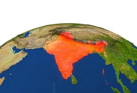
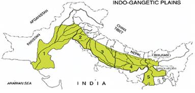
Indo-Gangetic Plain
The Indo-Gangetic Plain, also known as the North Indian River Plain, is a 700-thousand km2 fertile plain encompassing northern regions of the Indian subcontinent, including most of northern and eastern India, around half of Pakistan, virtually all of Bangladesh and southern plains of Nepal.
The region is named after the Indus and the Ganges rivers and encompasses a number of large urban areas. The plain is bound on the north by the Himalayas, which feed its numerous rivers and are the source of the fertile alluvium deposited across the region by the two river systems. The southern edge of the plain is marked by the Deccan Plateau. On the west rises the Iranian Plateau. Many developed cities like Delhi, Dhaka, Kolkata, Lahore and Karachi are located in the Indo-Gangetic Plain.
.jpg)
.jpg)