Description
Disclaimer: Copyright infringement not intended.
Context
- Seismic activities, construction loopholes, population pressure, and poor drainage systems are among the factors cited.
- The reports were made public only after the Uttarakhand High Court last week questioned the State for not disclosing them.
Details
Location of Joshimath
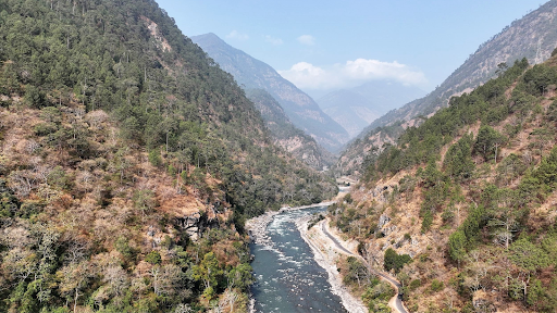
- Joshimath is a hilly town in Uttarakhand's Chamoli district, located on the Rishikesh-Badrinath National Highway (NH-7).
- The city is a tourist destination since it provides an overnight rest stop for visitors to Badrinath, Auli, Valley of Flowers, and Hemkund Sahib, among other notable religious and tourism destinations in the state.
- Joshimath is also strategically important to the Indian military, as it is home to one of the Army's most important cantonments.
- Running streams with a steep gradient from Vishnuprayag, a confluence of the Dhauliganga and the Alaknanda rivers, through the town (which falls in high-risk seismic Zone-V).
- It is home to one of Adi Shankara's four cardinal mathematics or monasteries: Sringeri in Karnataka, Dwarka in Gujarat, Puri in Odisha, and Joshimath in Badrinath in Uttarakhand.

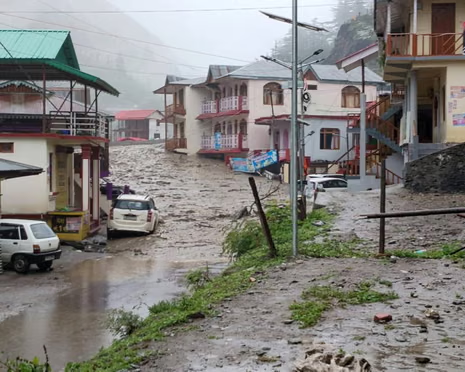
Studies of Different Institution regarding Land subsidence of Joshimath
- Separate studies conducted by eight premier institutions of India to know the cause of land subsidence in Joshimath town of Uttarakhand attributed seismic activities, construction loop wholes, population pressure, poor drainage system and others as the 'likely' reason for the sinking of the Himalayan town.
The Central Building Research Institute (CBRI) report
- In its report, the CBRI stated that Joshimath town has 44%, 42%, and 14% of masonry, RCC and other (traditional, hybrid) construction typologies, respectively, among which 99% are non-engineered.
- It means they are not in compliance with the National Building Code of India, 2016.
- Joshimath town is situated on Vaikrita groups of rocks overlain by morainic deposits which are composed of irregular boulders and clay of varying thick nesses.
- Such deposits are less cohesive and susceptible to slow subsidence and landslide subsidence.
- There is a history of creeping and occasional subsidence in the region and what happened in December 2022-January 2023 was another such event.
- The Roorkee-based NIH, in its report, said that maps of various springs, drainage networks and areas of subsidence infer that land subsidence and subsurface water in Joshimath might have some connections.
- The isotopic and water quality signature of the samples taken from NTPC sites differs from the JP site as well as drains and springs in the nearby area of Joshimath.
- The bacteriological analysis also suggested that the gushing water is fresh and not contaminated by the local drains; the report suggested giving a dean chit to the NTPC whose construction activities were being dubbed as one of the biggest reasons for land subsidence.
Recommendations
- The institutions hence recommended the safe disposal of the water coming from the upper reaches and waste disposal as the top priority.
Other Major Reasons
- The Wadia Institute of Himalayan Geology (WIHG) mentioned earthquakes as a reason for slow and gradual land subsidence.
- The main reason for the subsidence appears to be internal erosion caused by the subsurface drain age, which may be due to infiltration of rainwater/ melting of ice/wastewater discharge from households and hotels.
- Though subsidence is a continuous phenomenon, it can be minimized by controlling the infiltration of water, which helps in minimizing the internal erosion.
- After an analysis by the Small Baseline Subset Interferometry SAR Tech nique, the ISRO stated that the subsidence in the Joshi math region may be due to the toe-cutting phenomenon, slope instability as a result of seepage of local drain age water in the soil, terrain and edaphic characteristics, loose and unconsolidated moraine materials of the slope (due to old landslide) and flash flood events in and around the area in the recent past.
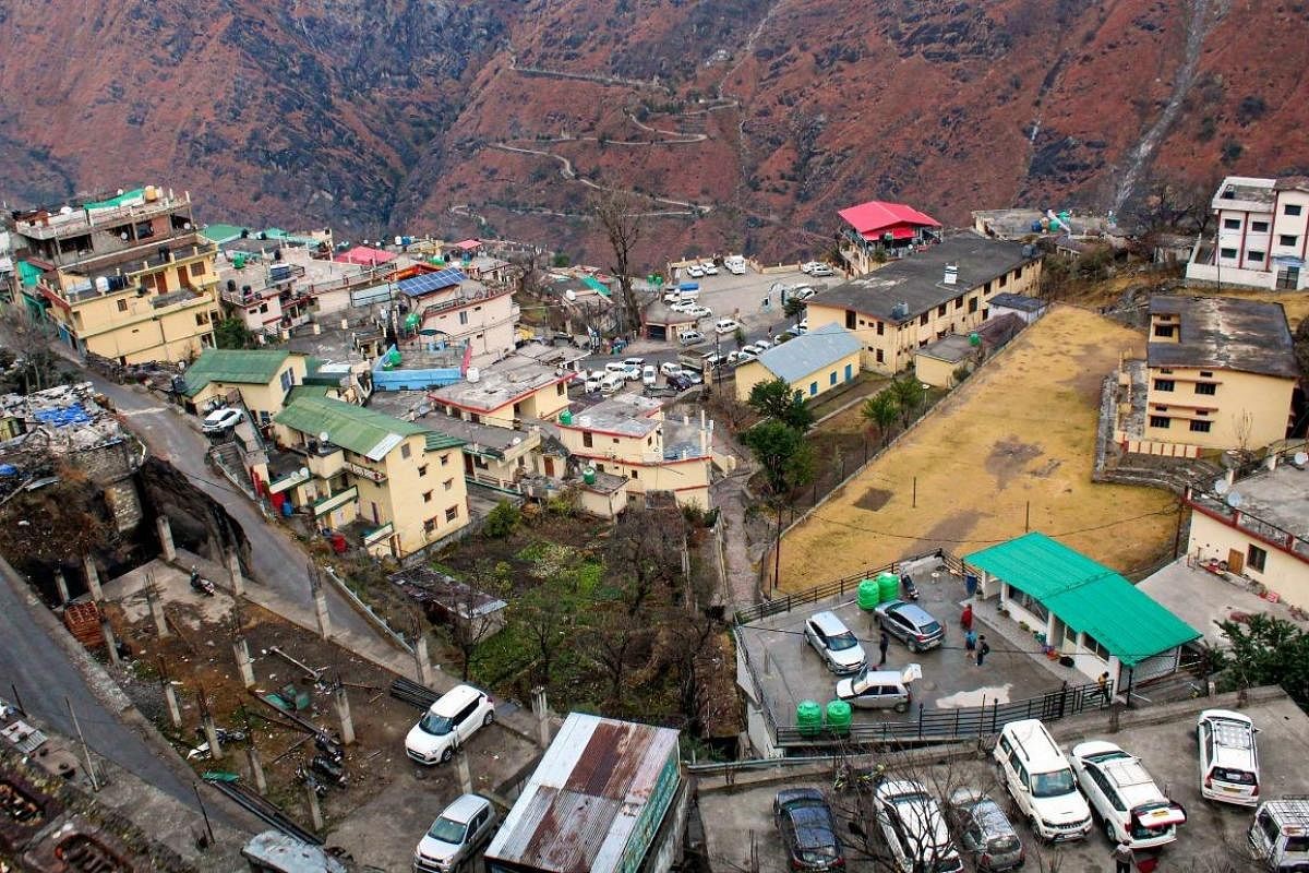
- This has resulted in the development of cracks in the ground as well as houses in Joshimath town.
.jpg)
What steps may be taken to save Joshimath?
- Experts urge that all development and hydroelectric projects in the region be halted completely. However, the immediate necessity is to transfer residents to a safer location and then redesign the town's development to meet the new variables and alter geographical features.
- One of the most important factors that needs to be investigated and improved is drainage planning.
- As more garbage seeps into the soil, loosening it from within, the city is suffering from poor drainage and sewer management.
- The state administration has urged the irrigation department to investigate the problem and develop a new drainage plan.
- Experts have also urged replanting in the region, particularly in sensitive areas, to preserve soil capacity.
- To rescue Joshimath, the government and civil authorities must work together, with the assistance of military groups such as the Border Roads Organisation (BRO).
- While the state already has weather-predicting technologies that can alert residents to local events, its coverage might be expanded.
- In Uttarakhand, weather forecasting is done using satellites and Doppler weather radars (instruments that use electromagnetic energy to detect precipitation and identify its position and severity).
- The state administration should also take scientific studies that clearly outline the causes of the current problem more seriously. Only then will the state halt its development.
|
PRACTICE QUESTION
Describe the different causes and effects of landslides. Mention the key elements of the National Landslide Risk Management Strategy.
|
Array
(
[0] => joshimath-sinking
[1] => daily-current-affairs
)