Description
Disclaimer: Copyright infringement not intended.
Context
Major 'magnetic anomaly' discovered deep below New Zealand's Lake Rotorua.
Details
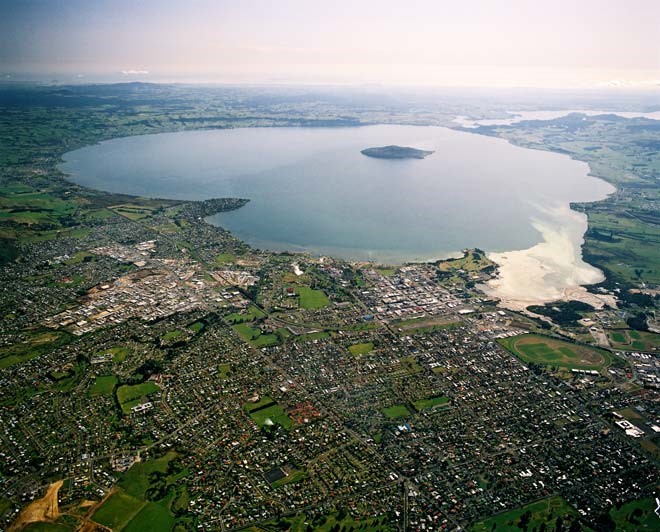
Lake Rotorua
- Lake Rotorua is the second largest lake in the North Island of New Zealand by surface area, and covers 79.8 km2. With a mean depth of only 10 metres it is considerably smaller than nearby Lake Tarawera in terms of volume of water. It is located within the Rotorua Caldera in the Bay of Plenty Region.
Formation
- The lake was formed from the crater of a large volcano in the Taupō Volcanic Zone. Its last major eruption was about 240,000 years ago. After the eruption, the magma chamber underneath the volcano collapsed.
- The circular depression left behind is the Rotorua Caldera, which is the site of the lake.
Geography
- Lake Rotorua is fed with water from a number of rivers and streams; some such as the Utuhina flow with a water temperature warmer than the lake due to the thermal activity in the Rotorua area.
- Conversely streams on the northern shore such as the Hamurana Spring and the Awahou stream flow crystal clear water that has a constant temperature of 10 degrees Celsius.
- Other notable tributaries include the Ngongotahā stream, famous for trout fishing.
- Lake Rotorua flows directly into Lake Rotoiti via the Ohau Channel at the north eastern corner of the lake.

Recent mapping of lake floor
- In 2024, maps of the lake floor were published, showing the results of surveys carried out in 2016 and 2017.
- The maps reveal the course of an ancient river, now submerged, and thousands of pockmarks that probably result from the emission of gas from decomposition of organic material beneath the lake floor.
- The surveys also revealed significant geothermal activity extending around 1 km (0.62 mi) into the lake from Sulphur Point.
Magnetic anomaly
- In geophysics, a magnetic anomaly is a local variation in the Earth's magnetic field resulting from variations in the chemistry or magnetism of the rocks. Mapping of variation over an area is valuable in detecting structures obscured by overlying material.
|
PRACTICE QUESTION
The Lake Rotorua often mentioned in news was formed from the crater of a large volcano in which of the following volcanic belt or Zone?
- Andean Volcanic Belt
- Garibaldi Volcanic Belt
- Taupo Volcanic Zone
- Trans-Mexican Volcanic Belt
Answer C
|


