Disclaimer: Copyright infringement not intended.
Context
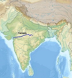
About Narmada River

Tributaries:
Dams:

Narmada Basin
|
PRACTICE QUESTION The Narmada River flows to the west, while most other large peninsular rivers flow to the east. Why?
Select the correct answer using the codes given below:
Answer: A |


© 2025 iasgyan. All right reserved