Description
Disclaimer: Copyright infringement not intended.
Context
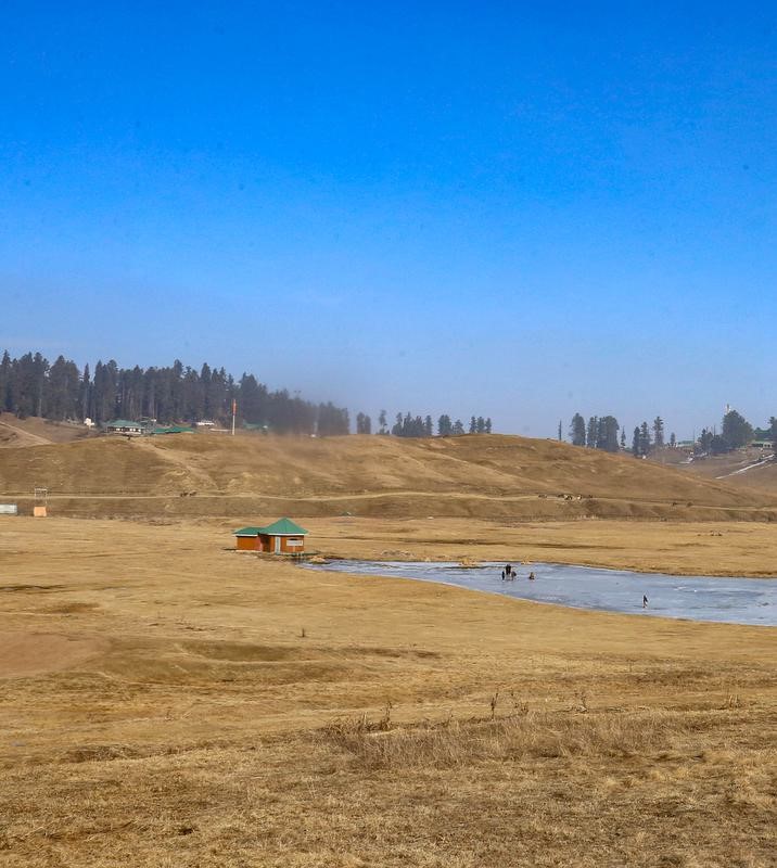
January is usually the month where Kashmir and Himachal Pradesh are blanketed with snow. This winter has, however, seen these regions extremely dry. Places like Gulmarg and Pahalgam, known to be popular destinations for skiing, have been unable to offer avenues for the winter sport.
Details
- Himachal Pradesh has witnessed dry slopes and valleys of brown grass. The Himalayan ranges of Uttarakhand have also reported minimal snowfall, with the first bout of snow in January at Auli, a popular hill resort, only reported on January 19.
- Records from the India Meteorological Department (IMD) suggest that Himachal Pradesh has registered its driest January since 1901, with a 99.7% shortfall in January rain compared to what is normal.
- Until this year, the record for the driest January was 1996, which reported a 99.6% shortfall.
What is the reason for the lack of snowfall?
- Snowfall requires adequate moisture as well as atmospheric temperatures to be zero degrees or less. Temperatures were fairly low since December.
- An analysis by the IMD in mid-January reported that maximum temperatures are running 5-8°C ‘below normal’ over the plains of north India since December 29.
- Minimum temperatures were also below 4 degrees Celsius at many stations of northwest India for most of January.
- This also resulted in a very dense fog persisting over the plains of northwest India. Several cities in the region reported zero visibility over the entire north-Indian plains from Amritsar to Dibrugarh across Haryana, Delhi, Uttar Pradesh and Bihar.
- While moisture and high aerosol loads contribute to fog, there were three major reasons behind the lack of snowfall and consequently intensifying cold waves over north India. These were a drastic fall in Western Disturbances (WDs) over northwest India; prevailing El-Nino conditions; and the absence of a strong jet stream.
How do these three factors influence snowfall?
- Decline in Western Disturbance: Western Disturbances are storms that originate in the mid-latitude regions and travel thousands of kilometres to bring rains to northern India.
- Such WDs in the winter dissipate fog and increase the sunshine incident on the ground raising temperatures.
- They also, when the temperatures are low, result in snowfall and water being available as snow melts. The melting glaciers contribute to the water available in the Ganga, Indus and Yamuna.
- On the other hand, they can also bring in hail, which is destructive to standing wheat crop. Usually, 5-7 WDs impact northwest India during December to January.
- But this winter there have been none. There were two WDs in this period, but their impact was mainly confined to Gujarat, north Maharashtra, east Rajasthan and Madhya Pradesh. As a result of the lack of these rains, the Western Himalayan Region got 80% less rain than normal.
- Role of Climate Change and El Nino: Prevailing El-Nino conditions over the equatorial Pacific Ocean, or warmer ocean temperatures, may also have had a role to play.
- However, irrespective of El Nino, or the converse, La Nina, the number of WDs in December and January have been on a decline.
- In the winter of 2022-23 (December and January), India reported its hottest ever December. The northwest region, which usually reports nearly a third of its rainfall during this season, saw an 83% rainfall deficit.
- In recent years, there has been a rise in these WDs in February and March that have caused flash floods, particularly in Uttarakhand and Himachal Pradesh. In 2023 for instance, saw record-breaking rain in February.
- In general, the traditional pattern of WDs have been disrupted since 2019, the last year we saw a conventional WD pattern.
- These instances of extended dry periods and intense wet spells are characteristic of global warming, as several meteorologists and climate scientists have been pointing out in recent years.

What role do the jet streams play?
- Jet streams are powerful winds, ranging from 250-320 kmph, travelling at about 12 km above mean sea level.
- They are carriers of the western disturbances but the lack of moisture means that so far, they have been contributing to the subsidence of cold air thereby enhancing the cold over north India.
- The jet streams set in after the withdrawal of the monsoon are also able to draw in moisture from the Arabian Sea.
- In recent years, the jet stream has been shifting northwards. This, emerging research suggests, is a consequence of a warming in the Arctic seas that affects the natural gradient of temperature necessary to ensure the strength and direction of the jet streams.
Implications of No Snowfall in Kashmir
- Short-term effects include an increase in forest fires, agricultural drought, and a drop in crop production.
- Long-term consequences include a reduction in hydroelectricity generation, an increase in glacier melting, and adverse effects on drinking water supply due to less recharge of groundwater.
- Crop: The winter snow, crucial for moisture in the soil, is vital for winter crops, particularly horticulture. The yields of apples and Saffron, significant contributors to the local economy, are adversely affected in the absence of sufficient snowfall.
- Tourism: Gulmarg, a key winter tourism spot in Kashmir, is witnessing a sharp decline in tourist visits this season due to insufficient snow. Despite substantial tourist numbers in 2023, officials project at least a 60% reduction in footfall.
- The scarcity of snow is adversely affecting ski resorts and related businesses, impacting the local economy.

Conclusion
Snowfall in Kashmir, however, is much more than just a tourist attraction. It is crucial for the local climate, winter crops and horticulture, availability of waters in streams and rivers, and for the local economy.
|
PRACTICE QUESTION
Why Kashmir and Ladakh are without snow this winter and discuss its implications in Indian context?
|


