Description
Disclaimer: Copyright infringement not intended.
Context
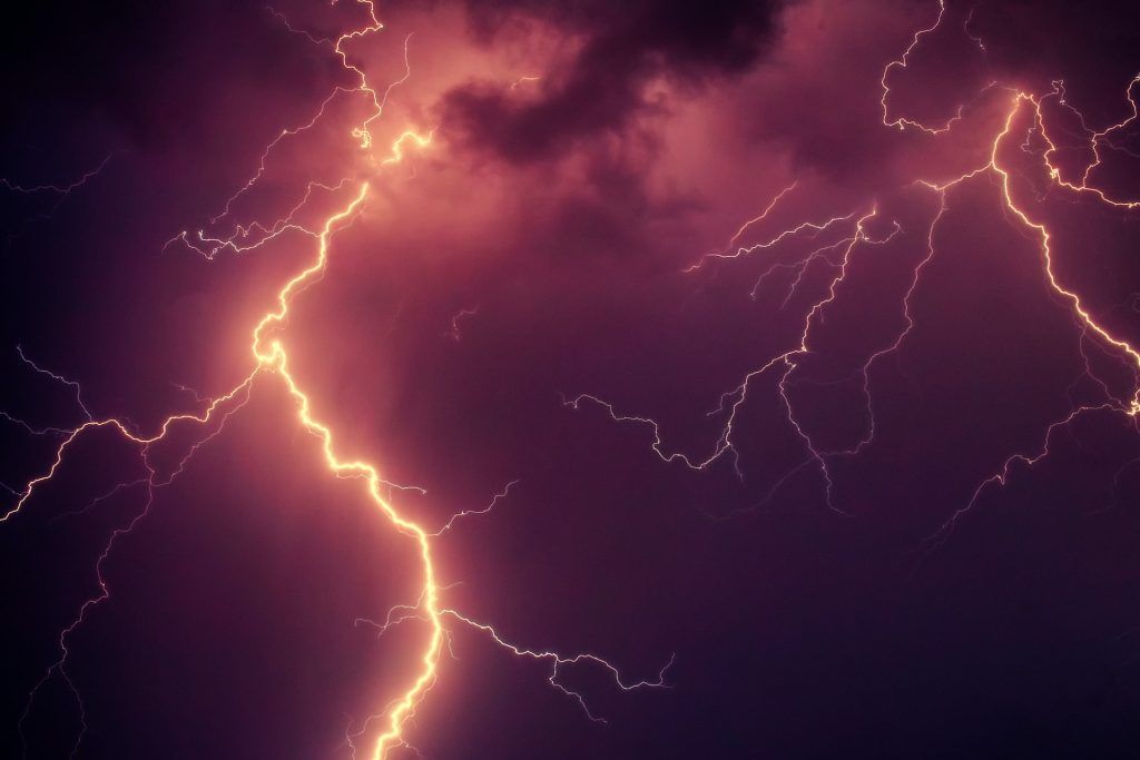
- A new study has found a significant statistical correlation between thunderstorms occurring around the world and the formation of wispy cirrus clouds - which might increase global warming.
Details
Cirrus clouds
- They are delicate, feathery clouds composed primarily of ice crystals.
- They have a thin and wispy appearance, resembling fragile high-altitude filaments or strands.
- Wind currents twist and distribute the ice crystals into strands, giving them their wispy appearance.
- They are often white or light grey. They are whiter than any other cloud in the sky during the day.
- They are usually referred to as "mare's tails" because they resemble the tail of a horse.
- Cirrus clouds, which are often found at elevations greater than 20,000 feet (6,000 meters), are comprised of ice crystals formed by the freezing of supercooled water droplets.
- They are more common in clear skies and point in the direction of air movement at their elevation.
Other cloud types
- Cumulus clouds are most common at elevations ranging from 4,000 to 7,000 meters and resemble cotton wool most of the time. They can be found in smaller patches and distributed over the area. They are flat on the bottom.
- Stratus clouds are large, horizontal, stratified, or layered clouds that cover large areas of the sky. The occurrence of these clouds is caused by the mixing of air masses with varying temperatures or in the case of less heat. The presence of stratus clouds in the atmosphere indicates a cold atmosphere.
- Nimbus Clouds are most commonly created in locations with lower heights. These clouds are black or dark grey in appearance. These clouds obstruct the sun's rays, resulting in severe rains and thunderstorms.
Classification of clouds according to the altitude
- Clouds are classified based on their development at various heights. The altitude at which different types of clouds arise varies depending on the polar region, tropical region, and so on.
Information about cloud
Types of clouds
High clouds
- Cirrus
- Cirrostratus
- Cirrocumulus
Middle clouds
Low clouds
- Stratocumulus
- Nimbostratus
Clouds with extensive vertical development

Thunderstorm
- A thunderstorm is an extreme atmospheric circulation characterized by huge, dense cumulonimbus clouds and powerful upward air movement. Thunderstorms create massive downpours, which is why they're called 'cloud bursts,' although the rain lasts only a few minutes.
- A thunderstorm is a type of weather event characterized by the presence of lightning, thunder, heavy rain, and, on rare occasions, powerful winds or hail.
- It is a storm that forms when warm, wet air rises quickly in an unstable environment. It is caused by convection.
Relation between Thunderstorm and Cirrus cloud
- A new study has found a significant statistical correlation between thunderstorms occurring around the world and the formation of wispy cirrus clouds—which might increase global warming.
- The cirrus clouds can contribute to global warming. However, it is very difficult to track these clouds and obtain accurate data about them.
- Findings indicate that a rise in the number of thunderstorms occurring globally might significantly increase the number of cirrus clouds, thereby exacerbating the climate crisis.
- Cirrus clouds, those feathery clouds we see in the sky, significantly impact the Earth's climate.
- An increase in these clouds will act as a blanket that increases warming, while a decrease will allow the heat of the Earth to rise and escape from the atmosphere.
- This is why climate researchers are highly interested in cirrus clouds, trying to predict potential changes due to the rise in greenhouse gases and global warming.
Issues
- It is very hard to obtain accurate, comprehensive data about cirrus clouds.
- Being so wispy, they can be invisible to the human eye and even to satellites, they form in the upper atmosphere, far from the monitoring stations operating on the ground.
- To address this challenge the researchers explored the possibility of predicting the quantity of cirrus clouds based on readily available data about thunderstorms and lightning activity.
- They explain that the brilliant flash of lightning is formed when a huge electric field is discharged instantaneously, generating a very high temperature of up to 30,000 degrees Centigrade in the lightning channel.
- The light waves and radio waves emitted by the lightning discharge can be detected even thousands of kilometers away, enabling long-term monitoring and mapping of thunderstorms.
Studies
- The present study is based on thunderstorm data collected worldwide over 6 years by the NASA satellite ISS-LIS which detects the light emitted by lightning.
- The researchers compared these data with data on cirrus clouds (the partial information available combined with supplementary models), looking for a correlation between lightning activity on a specific day, month, or year, and the amount of cirrus clouds formed in the upper atmosphere.
Findings
- Findings indicate a statistically significant correlation, with the number of cirrus clouds increasing with the number of thunderstorms.
- According to the researchers, this means that thunderstorms, which are easy to detect and measure, can be used as a reliable indicator for the amount of cirrus clouds in the atmosphere, today and in the future.
- It has been discovered that thunderstorms are a major mechanism in the formation of cirrus clouds and that lightning activity can account for over 70% of the changes in the number of cirrus clouds in the world.
- Thunderstorms act as an enormous "vacuum cleaner," lifting moisture from the surface of the planet, especially above oceans and forests, to higher levels of the atmosphere.
- There, at an altitude of about 10km, this moisture turns into ice crystals that form cirrus clouds.
- In this study, it is found a significant statistical correlation between the number of thunderstorms occurring across the globe at any given time and the number of cirrus clouds formed in the atmosphere.
- Many models predict that climate change will probably lead to an increase in thunderstorm activity in the coming years.
Closing thoughts
- According to this study, if these predictions are correct, the rise in the number of thunderstorms can be expected to cause an increase in the number of cirrus clouds as well.
- These clouds, in turn, acting as a kind of 'atmospheric blanket," will further exacerbate global warming.
PRACTICE QUESTION
- Explain cloud seeding, including its applications, difficulties, and concerns.
https://phys.org/news/2023-09-global-thunderstorm-quantity-wispy-cirrus.html
Array
(
[0] => daily-current-affairs/relation-between-thunderstorm-and-cirrus-cloud
[1] => daily-current-affairs
[2] => relation-between-thunderstorm-and-cirrus-cloud
)