The Ministry of Panchayati Raj recently announced revised Rural Area Development Plan Formulation and Implementation (RADPFI) Guidelines.
Background:
Rural areas have experienced rapid growth in recent years, yet this unplanned growth has resulted in inefficient use of geospatial potential in rural areas.
In India, rural areas account for 94% of land and 69% of the people, while urban areas account for 6% of land and 31% of the population.
As a result, there is a greater need to plan and modify the development of rural areas.
Need for Spatial Planning:
In the GPs Extended Urbanisation Area, there has been unplanned spatial growth.
The Birth of Census Towns
Improve the quality of life and long-term viability of Gram Panchayats.
Reforms and programmes must be integrated (SVAMITVA, RURBAN, New changes in State Acts & Amendments, re-emphasis on Disaster, Climate Change, Resilience Codes, etc.)
Need to be related to Agro-Climatic Regions/Zones that are linked to the Sustainable Development Goals
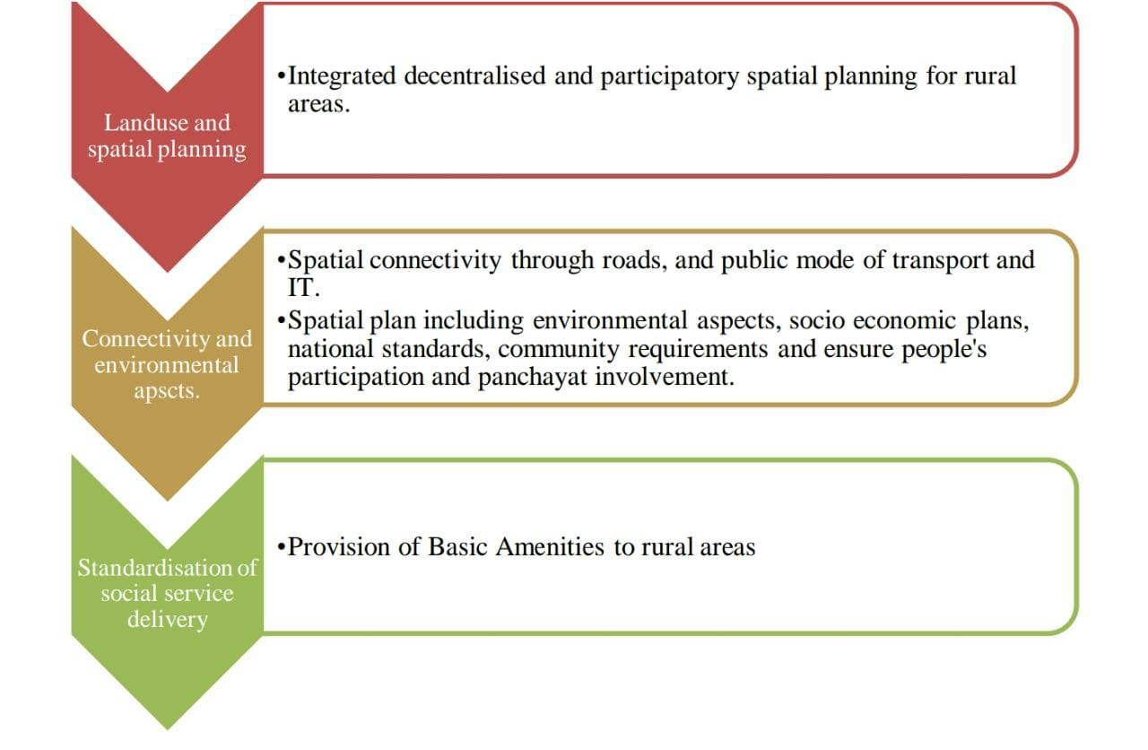
Rural Area Development Plan Formulation and Implementation (RADPFI)
Aim:
The goal is to have a planned spatial development for a village's entire integrated development.
Objectives:
Propose a methodological framework for producing Gram Panchayat Development Plans.
Developing a spatial norm for Gram Panchayat development, particularly in abadi areas.
To establish norms and criteria for the provision of infrastructure and utilities at the village level, as well as their integration with the spatial district plan.
Examine the provisions of the existing statutory framework and make appropriate adjustments so that a Rural/Village Development Plan can be prepared.
To recommend an institutional structure for putting the guidelines into action, as well as a road map for Gram Panchayat development.
Village Planning Schemes (VPS) are similar to Town Planning Schemes in urban regions.
Focus
Population, agro-climatic zones, Hill areas, disaster occurrence, urban-peri-urban areas and villages, Near to NH/SH, and Resilience techniques as indicated by BIS) are used to build the spatial development plan. There is no such thing as a one-size-fits-all solution.
Dealing with various development Land Use rules for various places, each with its own set of features. To make it easier for rural areas to develop in a coordinated manner.
VPS (Village Town Planning Scheme) - via Collaborative Planning with the community.
Environmental planning and catastrophe preparedness are also important considerations.
Connecting to the 15th CFC and their corresponding SFCs.
Using Spatial Data Infrastructure to Improve E-Government (SDI).
As per the 73rd and 74th CAA and GPDP, GP Development should be integrated/consolidated with RURBAN CLUSTERS/Block/District Plans.
Using SVAMITVA (and other digital tools) for the Abadi area is especially significant (linking to land records).
Need for Rural Area Development:
High population: The country has 6.4 lakh villages, with rural areas accounting for 68.84 percent of the overall population. These settlements exhibit a wide range of traits and levels of transformation from rural to urban.
Geographical Extent: The geographic extent of rural areas, both state-by-state and nationally, reveals that rural areas cover a large portion of the territory. Rural areas cover around 94 percent of India's total land area.
Mandatory by the Constitution: In the 73rd CAA, one of the responsibilities of Gram Panchayats is to design plans for economic development and social justice in their respective Gram Panchayats.
Wide economic activities: Rural areas are extremely adaptable, accommodating a wide range of agricultural, rural industry, tourism, basic raw material extraction, and mining activities.
Need for sustainable development: Rural land, on the other hand, contain land of great environmental significance, such as habitat for diverse species.
Conclusion:
The Rural Area Development Plan Formulation and Implementation (RADPFI) rules, which were just published, would alter rural India.
It will allow for more effective land use planning in rural regions, as well as an improvement in rural quality of life.
These guidelines will complement the Centre's initiatives, such as the SVAMITVA plan of the Ministry of Panchayati Raj and the RURBAN Mission of the Ministry of Rural Development, and will help to improve the use of geospatial data.