Disclaimer: Copyright infringement not intended.
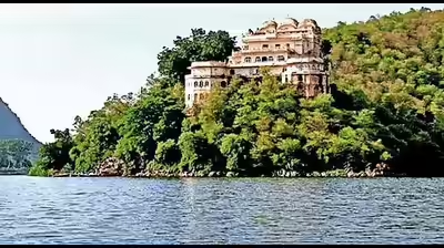
Climate change is believed to be impacting one of Uttarakhand's foremost trekking destinations, Roopkund Lake.
|
Attribute |
Details |
|
Location |
Chamoli district of Uttarakhand. It is part of Nanda Devi National Park. |
|
Altitude |
16,500 feet above sea level. |
|
Surroundings |
Mt. Trishul, Garhwal Himalayas, snow-capped peaks, lush green meadows. |
|
Climate and River |
Encased in ice for most of the year. It is a peri-glacial lake, fed by melting snow and glaciers around the area. |
|
Historical Mystery |
Known as the "lake of skeletons" due to large numbers of human skeletons date back to 850 AD with DNA studies suggesting two distinct groups of people, likely pilgrims, who died from a hailstorm. 2019 study by scientists from India, the US, and Germany shows these individuals came from diverse groups, including a Mediterranean lineage. |
The Nanda Devi National Park or Nanda Devi Biosphere Reserve, established in 1982 is a national park situated around the peak of Nanda Devi in Chamoli Garhwal district of Uttarakhand, in northern India. The entire park lies at an elevation of more than 3,500 m above mean sea level.
The national park was inscribed a World Heritage Site by UNESCO in 1988. It was later expanded and renamed as Nanda Devi and Valley of Flowers National Parks in 2005.
Fauna: Common larger mammals are Himalayan musk deer, mainland serow and Himalayan tahr. Himalayan gorals are not found within, but in the vicinity of the park.
Flora: Fir, birch, rhododendron and juniper are the main flora.
Read about National Parks here:
https://www.iasgyan.in/blogs/national-parks-in-india
READ ABOUT-
Dark tourism involves visiting sites of tragedy and suffering
Source:

|
PRACTICE QUESTION Q.Consider the following Lakes:
How many of the above-given lakes are located in Uttarakhand? (a) Only two (b) Only Three (c) Only Four (d) All five Answer: (c) Explanation: Sattal or Sat Tal is an interconnected group of seven freshwater lakes situated in the Lower Himalayan Range near Bhimtal, a town of the Nainital district in Uttarakhand. Kedartal is a glacial lake situated at an altitude of 4,750 metres in the Garhwal region of the Himalayas in India. Parashar Lake is a freshwater lake located at an elevation of 2,730 metres in the Mandi district of Himachal Pradesh, India. It lies 49 km east of the town of Mandi, and has a three storied pagoda-like temple dedicated to the sage Parashara situated on its bank. Chorabari Tal is a small lake that holds crystal clear water. Perched at an altitude of 3,900 m above sea level, Gandhi Sarovar lies on the foot of Kedarnath, Uttarakhand. Marinda Tal has been formed by a huge rock obstructing the flow of a river originating from the glaciers of Borasu pass. |

© 2025 iasgyan. All right reserved