Disclaimer: Copyright infringement not intended.
Context: Rwanda's President Paul Kagame has smashed his own record by winning Monday's elections with more than 99% of the vote.
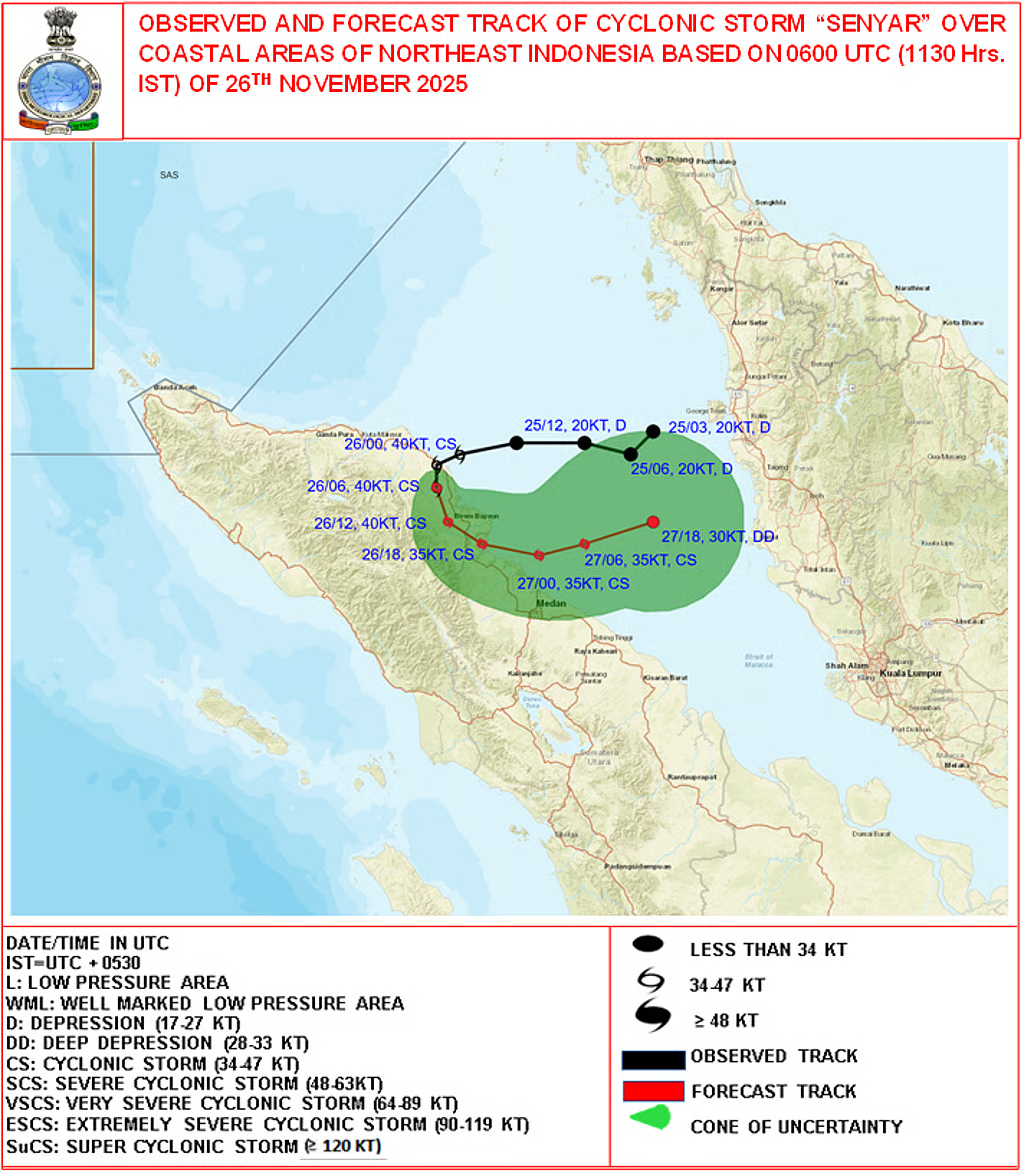
Details
|
Official Name |
|
|
Form Of Government |
|
|
Location |
|
|
Capital |
|
|
Currency |
|
|
Population: |
|
|
Official Languages: |
|
|
Area |
|
|
Ethnicity |
|
|
Bordering Countries |
|
|
Climate |
|
|
Physical Description. |
|
|
Volcano Mountains |
|
|
Drainage and Water body |
|
|
Vegetation |
Thick equatorial rainforest is found in the north and west of the country – forest covering some 18% of the total land area – and savannah in the east. Arable land comprises 49% and permanent cropland 10% of the total land area. |
|
Wildlife |
National parks and game reserves cover some 8% of the country and include the Volcanoes National Park (famous for its mountain gorillas) Akagera National Park (elephants, buffaloes, giraffes and zebras). |
|
Other Facts |
The Kigali Amendment to the Montreal Protocol is an international agreement to gradually reduce the consumption and production of hydrofluorocarbons (HFCs). |
Sources:
BBC.
|
PRACTICE QUESTION Q. consider the following countries 1. Uganda 2. Burundi 3. Tanzania 4. Nigeria How many of the above country/ies does not share border with Rawanda? A. Only one B. Only two C. Only three D. All four Answer B |

© 2025 iasgyan. All right reserved