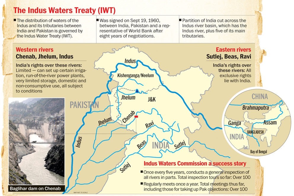
IAS Gyan

Daily News Analysis

Satluj River

3rd August, 2021 Geography

Context

  • Pollution in river Sutlej has posed serious health threats to the people living around the Indira Gandhi Canal.
  • The National Green Tribunal directed the Punjab and Rajasthan governments to submit quarterly compliance reports to Union Ministry of Jal Shakti (water resources), about the remedial action being taken to curb the inflow of effluent discharge into the Satluj and Beas.


About

  • Satluj, is the longest of the five rivers that flow through the historic crossroads region of Punjab in northern India and Pakistan.
  • The Sutlej River is also known as Satadree. Sutlej is an antecedent river.
  • An antecedent stream is a stream that maintains its original course and pattern despite the changes in underlying rock topography.
  • It is the easternmost tributary of the Indus River.
  • The source of the Sutlej is west of the catchment area of Lake Rakshastal in Tibet.
  • The nascent river flows at first west-northwest for about 260 kilometres under the Tibetan name Langqên Zangbo (Elephant River or Elephant Spring) to the Shipki La pass, entering India in Himachal Pradesh state.
  • It then has its main knee heading west-southwest for about 360 kilometres (220 mi) to meet the Beas River near Harike, Punjab. Ropar Wetland in Punjab state is located on the Sutlej river basin.
  • Evidence suggests Indus Valley Civilisation also flourished here.
  • Ungti Chu and Pare Chu rivers which drain southeastern part of Jammu and Kashmir state are tributaries of Sutlej river
  • The Bhakra Dam is built around the river Sutlej to provide irrigation and other facilities to the states of Punjab, Rajasthan and Haryana.
  • The waters of the Sutlej are allocated to India under the Indus Waters Treaty between India and Pakistan, and are mostly diverted to irrigation canals in India to include Sirhind canal, Bhakra Main Line and Rajasthan canal.
  • It has several major hydroelectric points, including the 1,325 MW Bhakra Dam, the 1,000 MW Karcham Wangtoo Hydroelectric Plant, and the 1,500 MW Nathpa Jhakri Dam.
  • The drainage basin is mainly in India's Himachal Pradesh, Punjab, Jammu and Kashmir and Haryana states.


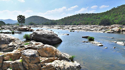
Satluj and pollution

  • One of the reasons for the pollution is Buddha nallah, a tributary of the Sutlej.
  • The Sutlej carries Class B water (moderate water pollution) before confluence of Buddha Nullah, but soon turns to Class E water (high degree of pollution making it unfit for any human or irrigation use) after the confluence of the nullah downstream of Ludhiana.
  • Traces of chromium and arsenic can be found in the Sutlej after confluence of Buddha Nullah.
  • Buddha Nullah and East Bein (a rivulet in Doaba in Punjab) are major point sources discharging treated / untreated wastewater into the Sutlej.
  • Buddha Nullah contributes about 16,672 kilogram a day of biological oxygen demand (BOD) load; East Bein contributes about 20,900 kg / day of BOD load.


Indira Gandhi Canal

  • The Indira Gandhi Canal (originally, Rajasthan Canal) is the longest canal of India.
  • It starts from the Harike Barrage at Harike, a few kilometers below the confluence of the Satluj and Beas rivers in the Indian state of Punjab and terminates in irrigation facilities in the Thar Desert in the north west of Rajasthan state.

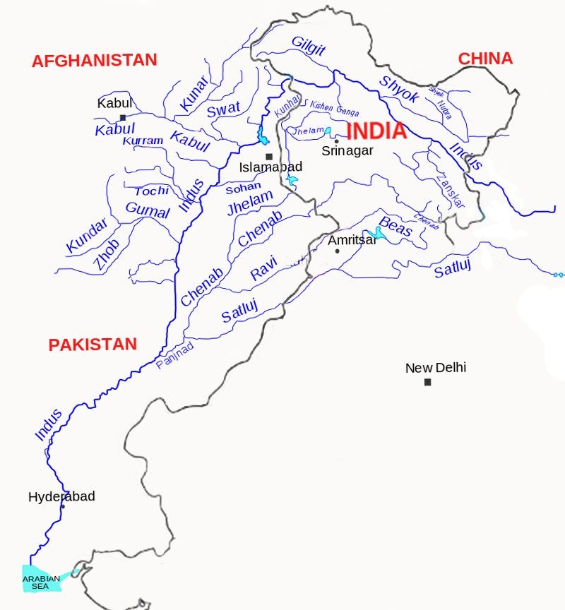
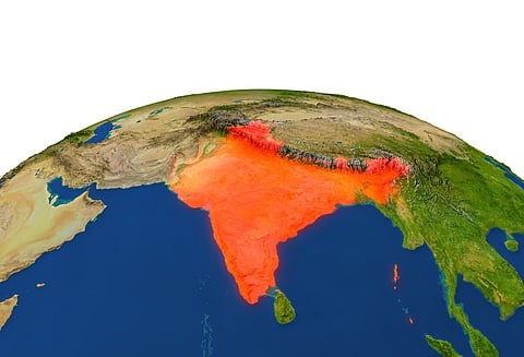
Major Rivers of Indus River System

     Source

Indus

Glaciers of Kailas Range (Close to Manasarovar Lake)

Jhelum

Verinag

Chenab

Bara Lacha Pass

Ravi

Near Rohtang Pass

Beas

Near Rohtang Pass

Satluj

Manasarovar-Rakas Lakes

Read: https://www.iasgyan.in/blogs/dams-in-jammu-and-kashmir


https://www.downtoearth.org.in/news/water/sutlej-river-pollution-millions-on-verge-of-health-risks-ngt-raises-alarm-78163