Description
Disclaimer: Copyright infringement not intended.
Context
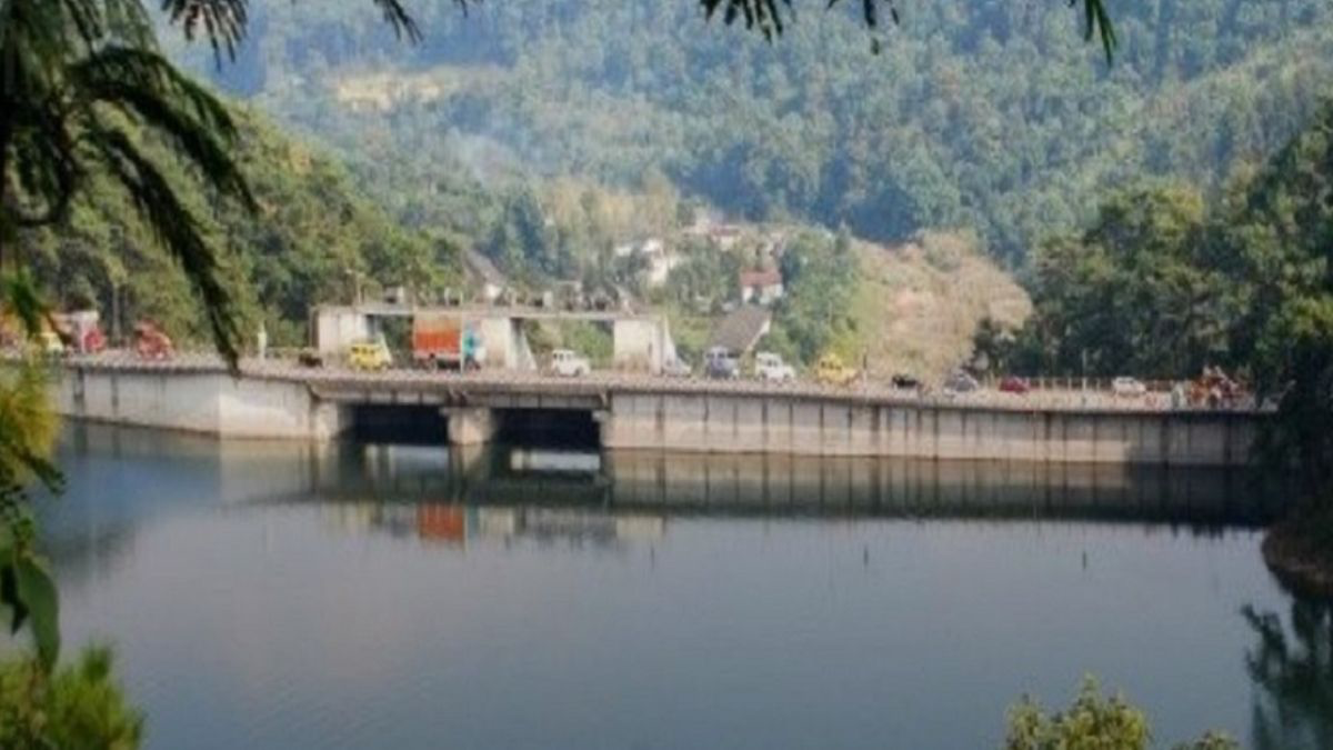
Warning issued by the Office of the Deputy Commissioner (DC) in Ri Bhoi district, Meghalaya, regarding the rising water level of Umiam Dam.
Details
- The Office of the Deputy Commissioner (DC) in Ri Bhoi district, Meghalaya has issued a warning regarding the rising water level of Umiam Dam.
- The water level reached 3205.75 feet as of July 14, prompting concerns about potential flooding.
Warning and Cautionary Measures
- The administration has cautioned residents living downstream of Umiam Dam.
- Strong advice is given to stay away from streams, drains, and culverts.
- Water may be released if the reservoir's level continues to rise, posing risks to affected areas.
Preparing for a Flood
- The DC's office emphasizes the need for necessary precautions in the event of a flood.
- Residents are urged to be prepared and take appropriate measures to ensure their safety.
- Stay updated with official communications and follow evacuation instructions if issued.
Avoiding Electrocution Risks
- Citizens are specifically warned to steer clear of electric poles and power lines.
- Flooding can pose a risk of electrocution due to contact with live electrical infrastructure.
- It is crucial to maintain a safe distance from such hazards to avoid potential harm.

About Umiam Dam
- Umiam Dam, also known as Barapani Dam, is a significant reservoir located in the Ri Bhoi district of Meghalaya, India.
- It is constructed on the Umiam River, a tributary of the Brahmaputra River.
- The dam serves multiple purposes, including water storage, hydroelectric power generation, and irrigation.
Purpose and Importance
- Umiam Dam serves as a storage reservoir, helping regulate the flow of water in the Umiam River and its downstream areas.
- The dam has a power station that harnesses the flow of water to generate electricity, contributing to the region's power supply.
- Water released from the dam is utilized for irrigation purposes, supporting agricultural activities in the surrounding areas.
Construction and Specifications
- Umiam Dam was constructed in the early 1960s as a part of the Umiam-Umtru Hydro-Electric Project.
- It is a concrete gravity dam, standing at a height of approximately 55 meters and having a length of about 1,009 meters.
- The dam has a reservoir with a storage capacity of around 320 million cubic meters.
Water Management and Flood Control
- The primary function of Umiam Dam is to manage water resources, preventing floods during periods of heavy rainfall.
- The reservoir helps regulate the flow of water downstream, minimizing the risk of flooding in the surrounding areas.
Hydroelectric Power Generation
- Umiam Dam plays a significant role in generating hydroelectric power for the region.
- The dam's power station has an installed capacity of 35 megawatts (MW) and contributes to the state's electricity supply.
Recreational Activities and Tourism
- The scenic beauty and the presence of the reservoir make Umiam Dam a popular tourist attraction.
- Boating, kayaking, and other water-based recreational activities are enjoyed by visitors, contributing to the local tourism industry.
Environmental Impact and Conservation
- The construction of the dam has resulted in the creation of a reservoir and altered the natural flow of the Umiam River.
- Environmental impact assessments are conducted to mitigate any potential adverse effects on the surrounding ecosystem and biodiversity.
|
PRACTICE QUESTION
Q) How can the coordination between various stakeholders be improved to minimize the impact of floods on vulnerable communities? Provide suitable examples and suggestions.
|

https://nenow.in/north-east-news/meghalaya/meghalaya-alert-issued-as-water-level-rises-in-umiam-dam.html