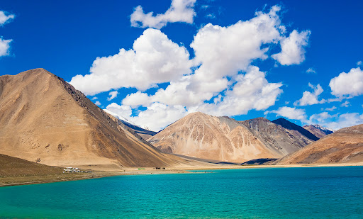
PANGONG TSO
Disclaimer: Copyright infringement not intended.
Context
- China is constructing a bridge in eastern Ladakh connecting the north and south banks of Pangong Tso (lake).
Geography
- Pangong Tso is an endorheic saline lake spanning eastern Ladakh and West Tibet.
- It has a land-locked basin separated from the Indus River basin by a small elevated ridge.
- It is 134 km long and divided into five sublakes, called Pangong Tso, Tso Nyak, Rum Tso (twin lakes) and Nyak Tso.
- The lake, a glacial melt, has mountain spurs of the Chang Chenmo range jutting down, referred to as fingers.
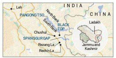
Pangong Tso and LAC
- Pangong Tso is in disputed territory. The Line of Actual Control passes through the lake.
- Approximately 50% of the length of the overall lake lies within Tibet China, 40% in Ladakh India and the rest is disputed and is a de-facto buffer zone between India and China.
- An Inner Line Permit is required to visit the lake as it lies on the Sino-Indian Line of Actual Control.
Recognition
- The lake is in the process of being identified under the Ramsar Convention as a wetland of international importance.
- This will be the first trans-boundary wetland in South Asia under the convention.
https://epaper.thehindu.com/Home/ShareArticle?OrgId=GL09C0ONP.1&imageview=0
1.png)