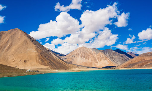
PANGONG TSO
Disclaimer: Copyright infringement not intended.
Context
- The government reiterated that it has had seen reports of a bridge being built by China on Pangong Lake alongside its earlier bridge. Both these bridges are in areas that have continued to be under the illegal occupation of China since the 1960s.
Must Read: Comprehensive Blog on India-China Border Dispute: https://www.iasgyan.in/blogs/india-china-border-dispute-decoded
Geography
- Pangong Tso is an endorheic saline lake spanning eastern Ladakh and West Tibet.
- It has a land-locked basin separated from the Indus River basin by a small elevated ridge.
- It is 134 km long and divided into five sublakes, called Pangong Tso, Tso Nyak, Rum Tso (twin lakes) and Nyak Tso.
- The lake, a glacial melt, has mountain spurs of the Chang Chenmo range jutting down, referred to as fingers.
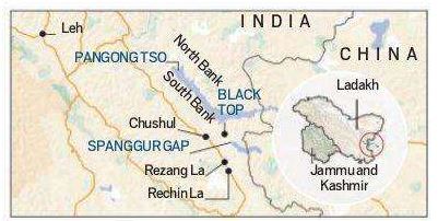
Pangong Tso and LAC
- Pangong Tso is in disputed territory. The Line of Actual Control passes through the lake.
- Approximately 50% of the length of the overall lake lies within Tibet China, 40% in Ladakh India and the rest is disputed and is a de-facto buffer zone between India and China.
- An Inner Line Permit is required to visit the lake as it lies on the Sino-Indian Line of Actual Control.
Recognition
- The lake is in the process of being identified under the Ramsar Convention as a wetland of international importance.
- This will be the first trans-boundary wetland in South Asia under the convention.
1.png)