SWOT SATELLITE
Disclaimer: Copyright infringement not intended.
Context
- A NASA-led international satellite was launched from Southern California, on a major Earth science project to conduct a comprehensive survey of the world’s oceans, lakes and rivers for the first time.
Details
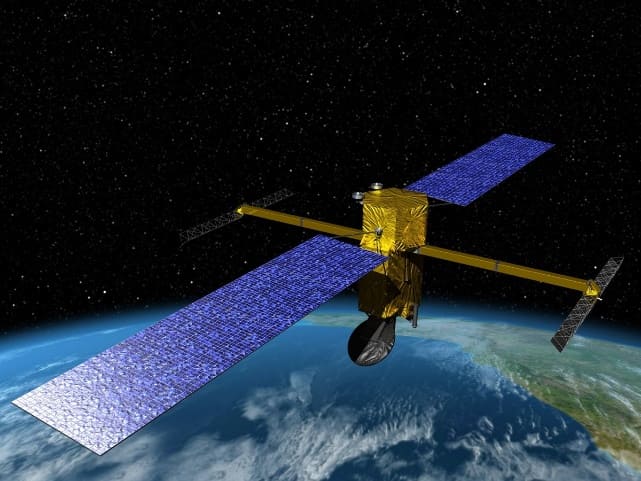
- Dubbed as SWOT (Surface Water and Ocean Topography, the advanced radar satellite is designed to give an unprecedented view of the life-giving fluid covering 70% of the planet, shedding new light on the mechanics and consequences of climate change.
- A Falcon 9 rocket, owned and operated by billionaire Elon Musk’s commercial launch company SpaceX, was set to liftoff from the Vandenberg U.S. Space Force Base, about 170 miles (275 km) northwest of Los Angeles, to carry SWOT into orbit.
- If all goes as planned, the SUV-sized satellite will produce research data within several months.
Nearly 20 years in development, the SWOT incorporates advanced microwave radar technology that scientists say will collect height-surface measurements of oceans, lakes, reservoirs and rivers in high-definition detail over 90% of the globe.
.jpg)
Significance
- The data, compiled from radar sweeps of the planet at least twice every 21 days, will enhance ocean-circulation models, bolster weather and climate forecasts and aid in managing scarce freshwater supplies in drought-stricken regions, according to researchers.
- It’s the first mission to observe nearly all water on the planet’s surface.
- One major thrust of the mission is to explore how oceans absorb atmospheric heat and carbon dioxide in a natural process that moderates global temperatures and climate change.
1.png)